-
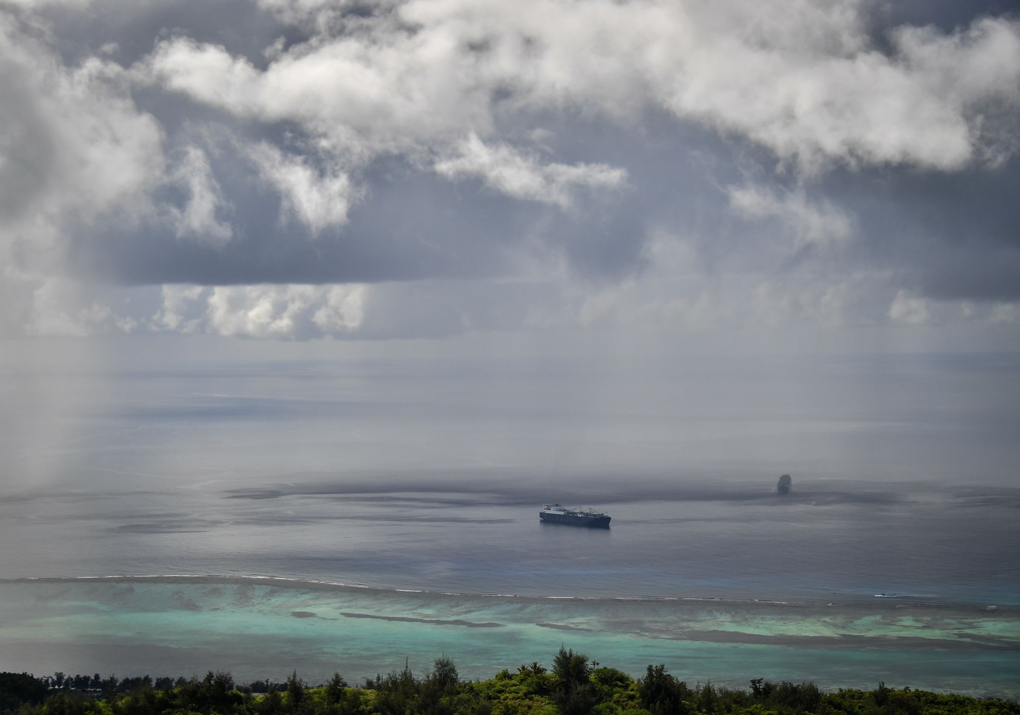
The Pacific Ocean as seen from top of Mount Tapochau on Saipan Island, one of the Northern Mariana Islands, in the Pacific Ocean. A strengthening Super Typhoon Yutu, with sustained winds of 180 mph, is on a trek through the Northern Mariana Islands. The storm is roaring across the islands of Saipan and Tinian, both U.S. territories, and will become among the most intense if not the strongest storm on record to impact U.S. soil. less
The Pacific Ocean as seen from top of Mount Tapochau on Saipan Island, one of the Northern Mariana Islands, in the Pacific Ocean. A strengthening Super Typhoon Yutu, with sustained winds of 180 mph, is on a … more
Photo: Yuri Smityuk/Yuri Smityuk/TASS
-
Saipan Island, one of the Northern Mariana Islands, in the Pacific Ocean. A strengthening Super Typhoon Yutu, with sustained winds of 180 mph, is on a trek through the Northern Mariana Islands. The storm is roaring across the islands of Saipan and Tinian, both U.S. territories, and will become among the most intense if not the strongest storm on record to impact U.S. soil.
less
Saipan Island, one of the Northern Mariana Islands, in the Pacific Ocean. A strengthening Super Typhoon Yutu, with sustained winds of 180 mph, is on a trek through the Northern Mariana Islands. The storm is
… more
Photo: Yuri Smityuk/Yuri Smityuk/TASS
-
Isleta Maigo Fahang (Bird Island) off Saipan Island, one of the Northern Mariana Islands, in the Pacific Ocean. A strengthening Super Typhoon Yutu, with sustained winds of 180 mph, is on a trek through the Northern Mariana Islands. The storm is roaring across the islands of Saipan and Tinian, both U.S. territories, and will become among the most intense if not the strongest storm on record to impact U.S. soil.
less
Isleta Maigo Fahang (Bird Island) off Saipan Island, one of the Northern Mariana Islands, in the Pacific Ocean. A strengthening Super Typhoon Yutu, with sustained winds of 180 mph, is on a trek through the
… more
Photo: Yuri Smityuk/Yuri Smityuk/TASS
-
Photo: Carlos Avila Gonzalez / The Houston Chronicle
-
window._taboola = window._taboola || [];
_taboola.push({
mode: ‘thumbnails-c’,
container: ‘taboola-interstitial-gallery-thumbnails-5’,
placement: ‘Interstitial Gallery Thumbnails 5’,
target_type: ‘mix’
});
_taboola.push({flush: true});
-
A fully charged cellphone should be among your hurricane survival items.
A fully charged cellphone should be among your hurricane survival items.
Photo: Getty Images/iStockphoto
-
A mobile phone charger will be necessary to keep your cellphone operational.
A mobile phone charger will be necessary to keep your cellphone operational.
Photo: Robert Kirk/Getty Images
-
Keep your laptop safe and close by. It can not only connect you to the outside world, but many of your important records may be stored in it.
Keep your laptop safe and close by. It can not only connect you to the outside world, but many of your important records may be stored in it.
-
As a backup, hurricane survival items should include a portable radio with good batteries. If the power fails, you’ll need an easy way to hear what’s happening in the outside world, including any evacuation instructions.
less
As a backup, hurricane survival items should include a portable radio with good batteries. If the power fails, you’ll need an easy way to hear what’s happening in the outside world, including any evacuation … more
Photo: Getty Images
-
window._taboola = window._taboola || [];
_taboola.push({
mode: ‘thumbnails-c’,
container: ‘taboola-interstitial-gallery-thumbnails-10’,
placement: ‘Interstitial Gallery Thumbnails 10’,
target_type: ‘mix’
});
_taboola.push({flush: true});
-
A battery-operated or rechargeable lantern is a safe option for lighting up your home. (AP Photo/Carlos Giusti)
A battery-operated or rechargeable lantern is a safe option for lighting up your home. (AP Photo/Carlos Giusti)
Photo: Carlos Giusti, STR
-
You’ll need a flashlight in case you have to leave home in the dark.
You’ll need a flashlight in case you have to leave home in the dark.
Photo: ST
-
Reliable batteries are always a part of any survival kit. Electrical power is often the first thing to go in an emergency.
Reliable batteries are always a part of any survival kit. Electrical power is often the first thing to go in an emergency.
Photo: File Photo/Hearst Connecticut Media
-
A well-stocked first aid kit is a must for a survival kit. There should also be a first aid kit in your vehicle in the event of a natural disaster.
A well-stocked first aid kit is a must for a survival kit. There should also be a first aid kit in your vehicle in the event of a natural disaster.
Photo: Carlos Avila Gonzalez / The Chronicle
-
window._taboola = window._taboola || [];
_taboola.push({
mode: ‘thumbnails-c’,
container: ‘taboola-interstitial-gallery-thumbnails-15’,
placement: ‘Interstitial Gallery Thumbnails 15’,
target_type: ‘mix’
});
_taboola.push({flush: true});
-
An array of useful and/or necessary items can be collected in one emergency backpack.
An array of useful and/or necessary items can be collected in one emergency backpack.
Photo: Carlos Avila Gonzalez, The Chronicle
-
Plywood sheets are a must for protecting windows and boarding up broken windows against the elements.
(Photo by Arnold Gold/New Haven Register)
Plywood sheets are a must for protecting windows and boarding up broken windows against the elements.
(Photo by Arnold Gold/New Haven Register)
-
Canned goods and non-perishable staples are a vital part of any hurricane survival kit.
Canned goods and non-perishable staples are a vital part of any hurricane survival kit.
Photo: Duane Prokop / Getty Images
-
If you have canned goods, you’ll need a can opener, although many cans now come with pull tops.
If you have canned goods, you’ll need a can opener, although many cans now come with pull tops.
Photo: Fuse, Getty Images/Fuse
-
window._taboola = window._taboola || [];
_taboola.push({
mode: ‘thumbnails-c’,
container: ‘taboola-interstitial-gallery-thumbnails-20’,
placement: ‘Interstitial Gallery Thumbnails 20’,
target_type: ‘mix’
});
_taboola.push({flush: true});
-
Sealed packages of granola bars, nuts and dried fruits contain a lot of energy and take up very little space.
Sealed packages of granola bars, nuts and dried fruits contain a lot of energy and take up very little space.
-
And don’t forget toilet paper. It really is a necessity.
And don’t forget toilet paper. It really is a necessity.
Photo: Tichakorn Khoopatiphatnukoon | EyeEm | Getty Images
-
Disinfectant wipes will probably be needed for sanitary purposes if the water supply becomes contaminated or untrustworthy.
Disinfectant wipes will probably be needed for sanitary purposes if the water supply becomes contaminated or untrustworthy.
Photo: File Photo/Hearst Connecticut Media
-
You’ll need gasoline for your emergency generator, if you have one, and for your car in case of an evacuation. You should fill up your car tank ahead of time.
You’ll need gasoline for your emergency generator, if you have one, and for your car in case of an evacuation. You should fill up your car tank ahead of time.
Photo: AP Photo/Mark Lennihan
-
window._taboola = window._taboola || [];
_taboola.push({
mode: ‘thumbnails-c’,
container: ‘taboola-interstitial-gallery-thumbnails-25’,
placement: ‘Interstitial Gallery Thumbnails 25’,
target_type: ‘mix’
});
_taboola.push({flush: true});
-
An emergency poncho, preferrably in reflective colors, helps complete a kit of disaster preparedness supplies.
An emergency poncho, preferrably in reflective colors, helps complete a kit of disaster preparedness supplies.
Photo: Carlos Avila Gonzalez, The Chronicle
-
Keep a mylar blanket handy. They’re water resistant, light and very warm. A mylar blanket sells for under $4 in most retail stores. (Melanie Stengel/Register)
Keep a mylar blanket handy. They’re water resistant, light and very warm. A mylar blanket sells for under $4 in most retail stores. (Melanie Stengel/Register)
-
Fill your prescriptions ahead of time if you can because it may be a while before you can fill them again. Keep those medicines safe and take them with you during evacuations. (File photo)
Fill your prescriptions ahead of time if you can because it may be a while before you can fill them again. Keep those medicines safe and take them with you during evacuations. (File photo)
Photo: Journal Register Co.
-
Keep all your preparedness items in one place — like this lightweight, waterproof storage bin — so they’ll be easy to find and transport in case of a quick evacuation.
Keep all your preparedness items in one place — like this lightweight, waterproof storage bin — so they’ll be easy to find and transport in case of a quick evacuation.
Photo: Dave Rossman, Freelance
-
window._taboola = window._taboola || [];
_taboola.push({
mode: ‘thumbnails-c’,
container: ‘taboola-interstitial-gallery-thumbnails-30’,
placement: ‘Interstitial Gallery Thumbnails 30’,
target_type: ‘mix’
});
_taboola.push({flush: true});
Photo: Yuri Smityuk/Yuri Smityuk/TASS
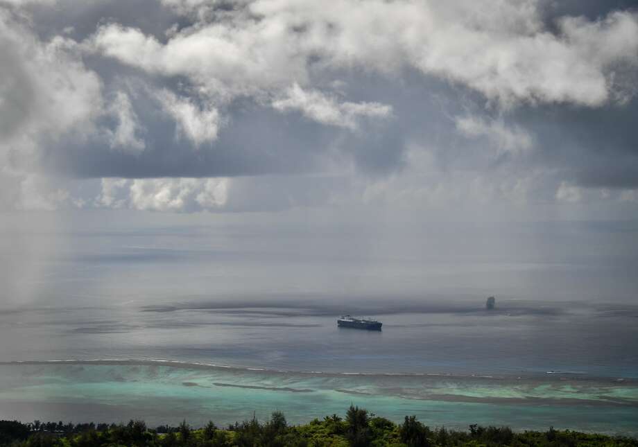
The Pacific Ocean as seen from top of Mount Tapochau on Saipan Island, one of the Northern Mariana Islands, in the Pacific Ocean. A strengthening Super Typhoon Yutu, with sustained winds of 180 mph, is on a trek through the Northern Mariana Islands. The storm is roaring across the islands of Saipan and Tinian, both U.S. territories, and will become among the most intense if not the strongest storm on record to impact U.S. soil. less
The Pacific Ocean as seen from top of Mount Tapochau on Saipan Island, one of the Northern Mariana Islands, in the Pacific Ocean. A strengthening Super Typhoon Yutu, with sustained winds of 180 mph, is on a … more
Photo: Yuri Smityuk/Yuri Smityuk/TASS
Earth’s strongest storm this year headed for US territories
The Earth’s strongest storm this year is about to strike U.S. territories in the western Pacific Ocean.
A strengthening Super Typhoon Yutu, with sustained winds of 180 mph, is on a trek through the Northern Mariana Islands.
The storm is roaring across the islands of Saipan and Tinian, both U.S. territories, and will become among the most intense storms – if not the most – on record to impact U.S. soil.
The Joint Typhoon Warning Center now considers Yutu an incredibly strong Category 5 equivalent typhoon. Because reconnaissance planes do not fly in the western Pacific to directly measure conditions inside storms, the intensity of 180 mph, or 155 knots, is based on estimates from satellites.
Meteorologist Ryan Maue of WeatherModels.com tweeted that the storm would be a “Category 6 if Atlantic scale was extrapolated.”
According to Phil Klotzbach of The Washington Post, Yutu is “tied with Mangkhut for the strongest storm of the 2018 season to date.” If it strengthens further, Yutu will rank among the all-time most intense storms ever recorded.
“This is an historically significant event,” tweeted Michael Lowry, a hurricane specialist with the Federal Emergency Management Agency.
While the western Pacific is where the world’s most powerful tropical cyclones tend to form, Yutu’s strength is likely to be unprecedented in modern history for the Northern Mariana Islands. The islands are home to slightly more than 50,000 people, a majority of whom live in the largest, northernmost island of Saipan.
Yutu is passing through the island chain. In Saipan, wind gusts to hurricane force have been recorded, and much worse will move through as the eye of the storm passes. Gusts could top 200 mph.
A terrifying, grating wind can be heard in audio of a live EarthCam broadcasting from the island. As the storm approached Saipan, the pressure was plummeting at an astonishing rate.
The islands of Tinian and Saipan are taking the eyewall of the right-front quadrant of Yutu, which is typically where a storm’s most severe conditions are found. Extreme destruction and suffering in both the short and long term should be anticipated in these areas.
The National Weather Service’s advisory for the islands conveyed a dire message, warning of “devastating damage” from the “collapse of residential structures,” partial or total destruction of industrial and apartment buildings, and loss of water and electricity for days to weeks.
In addition to winds that will flatten structures and forests, a storm surge as high as 20 feet is possible in the hardest-hit coastal locations. Storm surge acts as a storm-driven tsunami, and the 20 feet of surge doesn’t count battering waves. Rainfall approaching or surpassing one foot is likely to also lead to freshwater flooding and landslides.
It’s a classic and absolutely textbook storm on satellite, resembling a buzz saw. You don’t see them much more intense
After passing the Mariana Islands, Yutu is likely to maintain an intensity close to its peak for the next day or two before slowly weakening as it moves into the Philippine Sea. Models are mixed on whether Yutu will strike more land at that point. The Philippines to Japan should certainly keep an eye out.
 The Pacific Ocean as seen from top of Mount Tapochau on Saipan Island, one of the Northern Mariana Islands, in the Pacific Ocean. A strengthening Super Typhoon Yutu, with sustained winds of 180 mph, is on a trek through the Northern Mariana Islands. The storm is roaring across the islands of Saipan and Tinian, both U.S. territories, and will become among the most intense if not the strongest storm on record to impact U.S. soil. lessThe Pacific Ocean as seen from top of Mount Tapochau on Saipan Island, one of the Northern Mariana Islands, in the Pacific Ocean. A strengthening Super Typhoon Yutu, with sustained winds of 180 mph, is on a … more


